
When it comes to the energy industry, understanding the ground beneath our feet is crucial. Geotechnical surveys are the bedrock of safe and successful projects, providing essential data for construction and development. This article delves into what a geotechnical survey is, its importance, and why it's indispensable for Malaysia's dynamic landscape.
What is a Geotechnical Survey?
A geotechnical survey is an investigative process that evaluates the physical properties of soil and rock beneath a construction site. This survey identifies potential issues that might affect the stability and safety of the proposed development. By examining soil composition, density, groundwater conditions, and other factors, geotechnical surveys provide a comprehensive understanding of subsurface conditions.Why Conduct a Geotechnical Survey in Malaysia?
Conducting a geotechnical survey in Malaysia is vital due to the diverse geological features across the region. This process helps in mitigating risks associated with construction projects, ensuring structures are built on solid and stable foundations. Here's why geotechnical surveys are crucial:- Risk Mitigation: Identifying potential hazards such as landslides, soil liquefaction, and subsidence.
- Cost Efficiency: Preventing costly delays and repairs by addressing issues before construction begins.
- Design Optimization: Providing data to engineers for designing foundations and structures that are safe and efficient.
- Regulatory Compliance: Meeting local building codes and regulations to ensure project approval.

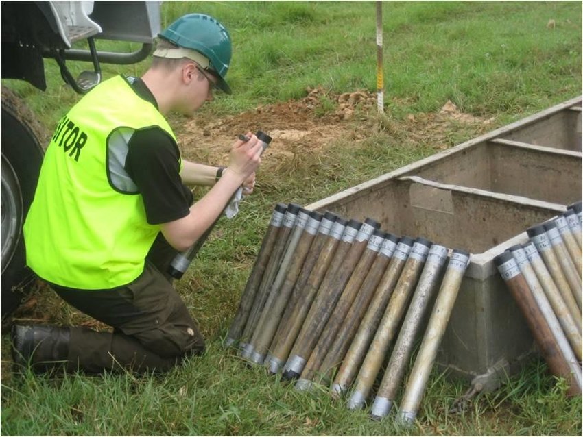
Souce: Borehole Solutions
The Process of Geotechnical Surveys
Geotechnical surveys in Malaysia typically involve several key steps to gather comprehensive data:Site Investigation
The first step in a geotechnical survey is a thorough site investigation. This involves studying the site’s history, geology, and existing conditions. Engineers and geologists examine topographical maps, satellite images, and previous survey reports to understand the site’s characteristics.Soil Sampling and Testing
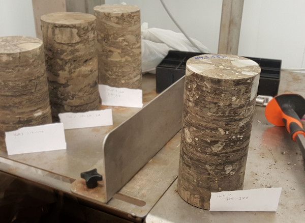
Soil sampling is conducted using boreholes, test pits, and other methods to collect soil and rock samples from different depths. These samples are then tested in laboratories to determine their properties, such as:- Grain Size Distribution
- Moisture Content
- Shear Strength
- Compressibility
Source: ResearchGate
Source: Geofrost
Geophysical Methods
Geophysical methods, including seismic refraction, ground-penetrating radar, and electrical resistivity, are employed to map subsurface conditions without extensive drilling. These techniques help in identifying subsurface anomalies and understanding soil and rock layering.Data Analysis and Reporting
The collected data is analyzed to develop a geotechnical report. This report provides detailed information on soil properties, groundwater levels, and potential geohazards. It also includes recommendations for foundation design, site preparation, and other construction considerations.Applications of Geotechnical Surveys in Malaysia
Geotechnical surveys are indispensable for various sectors, including:- Oil and Gas: Ensuring the stability of drilling rigs, pipelines, and offshore structures.
- Construction: Guiding the design and construction of buildings, bridges, and roads.
- Infrastructure Development: Assisting in the planning and execution of projects like dams, tunnels, and airports.
- Marine Services: Providing critical data for the safe construction and maintenance of ports, harbors, and offshore facilities.